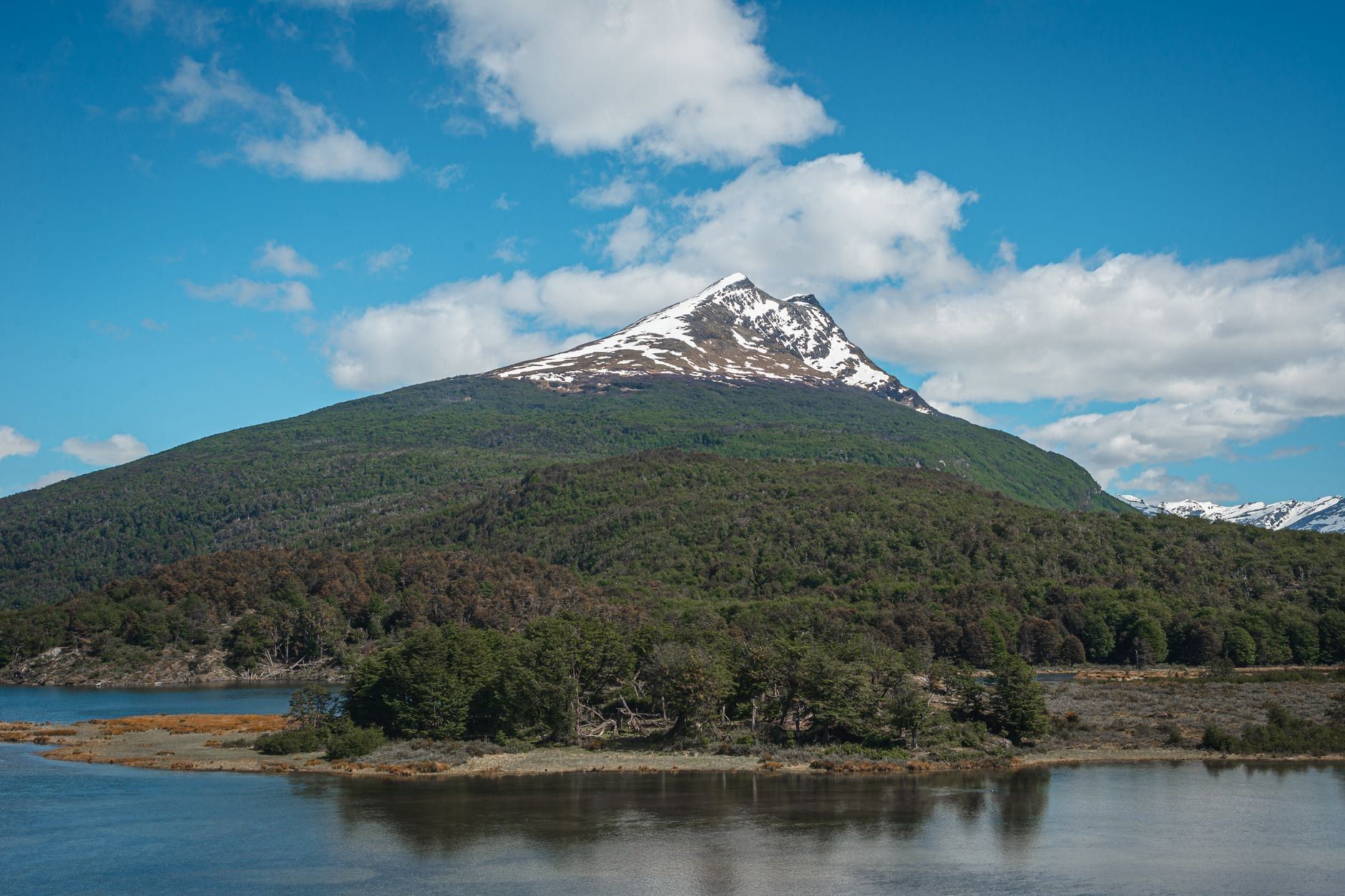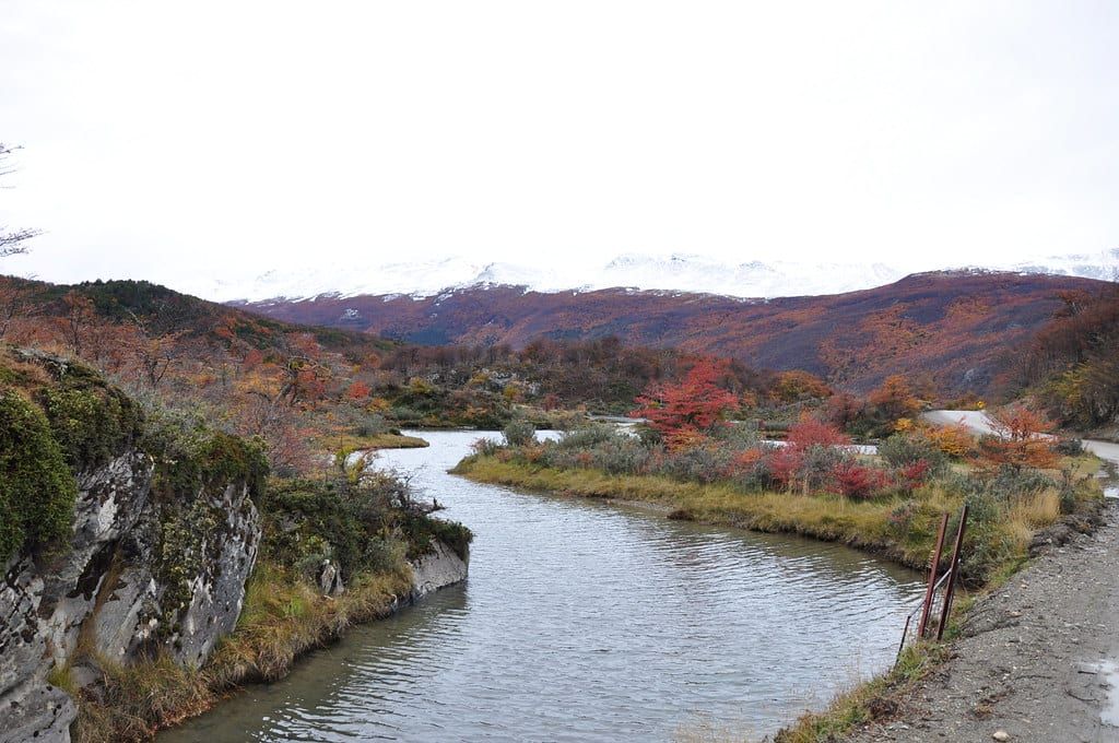
Tierra del Fuego National Park packs ten marked trails and roughly 40 km of path into its southern corner, 12 km west of Ushuaia at the tip of South America. It's Argentina's only coastal national park: the last ridge of the Andes drops straight into the Beagle Channel, and Ruta 3 dead-ends at Bahía Lapataia, the southern terminus of the Pan-American Highway. Nearly every hiker bases in Ushuaia and rides the shuttle in.
This guide covers all ten trails with distances, times and difficulty, three day routes built around real shuttle times, and the logistics — fees, seasons, gear — that decide whether your day works. One day covers the park's best hike plus the short trails. Two adds a summit. If you only read one section, make it the trail table below.
Tierra del Fuego Hiking at a Glance
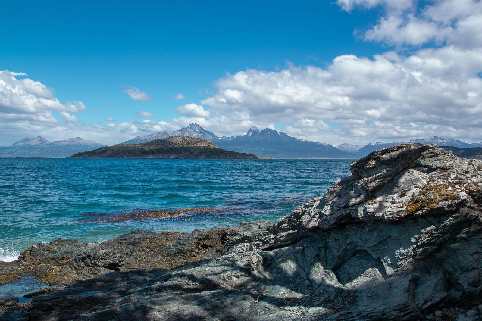
The park protects 68,909 hectares of subantarctic Andean forest, but only the southern sector — about 2,000 hectares — is open to the public. Everything else is strict nature reserve. Within that open slice you get ten marked trails: four long ones (Pampa Alta, Costera, Hito XXIV, Cerro Guanaco) and six short, easy ones clustered at the end of Ruta 3.
Know what you're walking through before you go. The forest is lenga and guindo beech, the low ground is peat bog, and big patches of dead, grey trunks stand in flooded water along several trails — North American beavers introduced in 1946 have no predators here, and their dams have drowned whole stands of forest. Add wind, mud and root-laced tread, and you have a park that looks wilder and stranger than most of Patagonia. That flooded dead forest is genuinely photogenic, for what it's worth.
| Trail | Distance | Time | Difficulty | Best for |
|---|---|---|---|---|
| Senda Costera | 8 km one way | 3–4 h | Medium | Most visitors; coastal walking |
| Senda Pampa Alta | 3.7–4.9 km one way | 2–3 h | Medium | A ridge view without a summit day |
| Hito XXIV | 7 km round trip | 5–6 h | Easy–moderate | Quiet lakeshore to the Chile border |
| Cerro Guanaco | 8 km round trip | 4 h up | Hard | Panorama seekers in good weather |
| Lapataia sampler | ~4 km total | 1.5–2 h | Easy | Families and tight schedules |
Half-day visitor: the Lapataia sampler. One-day hiker: Senda Costera plus short trails. Summit-seeker: Cerro Guanaco, with Pampa Alta as the weather fallback. Backpacker: Laguna del Caminante, 25 km with a night at the lagoon. Everything else in this guide is detail on those five calls.
The Long Trails
Four of the park's trails need half a day or more, and each suits a different hiker. All four are closed in winter — the park shuts them between roughly April and September for ice and snow.
Senda Costera
This is the hike most people come for. Eight kilometres of coast from Ensenada Zaratiegui to Lapataia Bay, one way, through lenga and guindo forest, rocky coves and small pebble beaches right on the Beagle Channel. It's medium difficulty, takes 3–4 hours, and is often wet underfoot. Start at Ensenada Zaratiegui (the southernmost post office in the Americas sits at the trailhead — postcards and an unofficial passport stamp) and walk west toward Lapataia, so the wind and the shuttle both work in your favour. Arriving at the far end, you're at the Alakush Visitor Centre and the Lapataia trail cluster, with pickups nearby. Seabirds and beaver dams the whole way.
Senda Pampa Alta
The shortcut to a view. Pampa Alta runs 4.9 km from Ensenada Zaratiegui, or 3.7 km if you start from Ruta 3, climbing through forest to open panoramas of the Beagle Channel, the Pipo River valley and Cerro Guanaco. Medium difficulty, a couple of hours. If the Guanaco summit is shut or the wind is up, this is the viewpoint you do instead — and with the Ruta 3 start, it fits a half day comfortably.
Hito XXIV
A lakeshore walk to the Chilean border, and the quietest of the long trails. From the Lago Acigami parking stop, the trail follows the lake's northwest shore for 3.5 km — about 7 km round trip — to border milestone XXIV, taking roughly three hours each way. Lago Acigami is shared with Chile, and the mountains framing it are mostly Chilean too. No passport needed: the trail ends at the marker and you don't cross. Bring lunch; the lakeshore beaches are the park's best picnic spots.
Cerro Guanaco
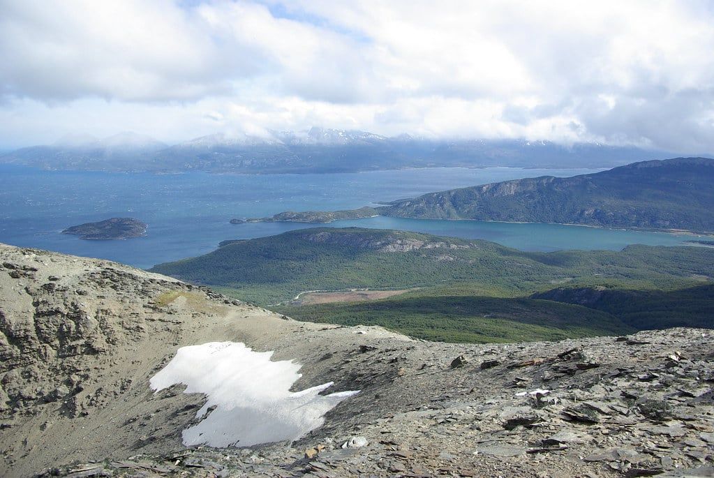
The park's hardest and best day out. Nearly 4 km of steep, unrelenting uphill from near Alakush — about 8 km round trip — to the park's best panorama at 975 m, with the Fuegian range, the Beagle Channel and the peat bogs all in one sweep. Four hours to the top. Registration with rangers at entry and exit is mandatory, and wind is the reason hikers get turned back: this is an exposed ridge, and 20 mph is an average day in this park, not a bad one. If the forecast screams, swap in Pampa Alta. Closed all winter.
Laguna del Caminante
The overnight option, and a different league. Roughly 25 km one way from the Valle de Andorra to Cañadón de la Oveja, partly inside the park, rated strenuous. You camp near the lagoon — permitted, free, no facilities, no toilets. Trekking poles are a genuinely good idea given the bog crossings on the descent. Check in with rangers before you start, carry everything out, and don't attempt it as your first overnight hike. Fit walkers who've done a few multi-day treks will love it.
Short & Easy Trails in the Lapataia Sector
Six short trails cluster at the end of Ruta 3 around Lapataia Bay, all low difficulty, all interconnected. From the Bahía Lapataia shuttle stop you can sample three or four of them in 1.5–2 hours flat walking. This is the right answer for families, cruise-day schedules, or the afternoon after a long morning trail.
Paseo de la Isla
About 900 m along the Lapataia and Ovando rivers to the Laguna Verde viewpoint, with the most birdlife of the six. Flat, easy, stroller-friendly.
Laguna Negra
A 950 m boardwalk-and-path loop out to a black peat-bog lagoon — dark water ringed by sponge bog, and a good primer on what most of this island's interior looks like.
Mirador Lapataia
A short climb of roughly 1 km to the classic panorama over Lapataia Bay. Note the timing: tour buses disgorge at the parking below, so midday means sharing the view with forty new friends. Go before 11 or after 4.
Del Turbal
Two kilometres through peat bog and past beaver lodges, the longest of the short trails. Expect boardwalk over the wettest stretches.
Castorera
Four hundred metres to an overlook of beaver dams and a flooded forest — the quickest possible lesson in why the park's dead trees exist.
Senda de la Baliza
1.5 km each way toward a lighthouse viewpoint, opening with a wheelchair-accessible boardwalk to a viewing point and passing pebble beaches and an abandoned beaver lodge. If someone in your group can't manage forest trails, this and the Lapataia Bay boardwalks are the walks to do.
The obvious sampler loop from the last shuttle stop: Paseo de la Isla, then Laguna Negra, then Mirador Lapataia, finishing at the end-of-Ruta-3 sign by the bay. Two hours at family pace. The park lists five of these six as family-friendly trails; just keep children back from the water — the Beagle Channel runs 4–8°C even in summer, with no lifeguards anywhere.
Sample One-Day Hiking Routes
Three ways to spend a day, built around the shuttle reality: first bus out of Ushuaia around 8 am, afternoon returns around 3, 5 and 7 pm in season. Confirm the timetable with your driver on the way in — departure times are the one detail that can wreck an otherwise perfect plan.
The Full-Day Coast Route (~12 km)
Take the first shuttle to Ensenada Zaratiegui, stamp your passport at the post office, and walk the Senda Costera west. Lunch at the Alakush Visitor Centre when you pop out near Lago Acigami, then spend the afternoon on Paseo de la Isla, Laguna Negra and Mirador Lapataia, finishing at the end-of-Ruta-3 sign at Bahía Lapataia. One hiker's tracked version of exactly this came to 12 km with about 150 m of elevation gain, walked between 11:50 am and 5:30 pm, finishing well before the 7 pm shuttle. If you start at 8 am instead, you've got slack for a long lunch and the Baliza trail too.
The Half-Day Lapataia Sampler
Short on time, or off a cruise ship? Ride the shuttle straight to Bahía Lapataia and do the sampler loop above — bay boardwalks, peat bog, beaver dams, the end-of-the-road sign. Two hours covers it. If you'd rather have a guide and the transport handled, half-day tours run the same circuit in 4–5 hours with hotel pickup; for everything else you could bolt onto a Ushuaia stay, see our things to do in Tierra del Fuego guide.
The Cerro Guanaco Summit Day
Take the earliest shuttle, register with the rangers, and be climbing by mid-morning — four hours up, three down, back at Alakush for a late lunch. Check the wind forecast the night before and again at the entrance; if it's howling, pivot to Pampa Alta and keep Guanaco for another day. And if you finish early with daylight to spare, penguin tours from Ushuaia run to Martillo Island and the Beagle Channel colonies through late March.
Getting There from Ushuaia
The park is 12 km west of town along Ruta 3 — 20–30 minutes by car, about 45 with shuttle stops. For the full transport rundown we keep a separate page; the hiker's version is below.
The Shuttle
Vans leave from the corner of Fadul and Maipú by the bus terminal in central Ushuaia. A return ticket cost about AR$20,000 cash or AR$25,000 by card as of early 2025, and you buy on site — no advance booking; it's a mildly chaotic multi-operator affair where you're assigned whichever van has seats. Seven stops inside the park: the entrance, the train station, Ensenada Zaratiegui, Alakush, Lago Acigami/Roca, Isla Entre Ríos and Bahía Lapataia. That last fact is the key to the whole day — you can hike one direction and ride back from wherever you finish. Ask the driver about return pickup times before you get off.
Taxi, Rental Car and Bike
A taxi half-day circuit of the main stops ran about US$100 in early 2026 — agree the price and the pickup time before setting off, since a waiting driver can shuttle you between trailheads. A rental car is the most flexible option and parking is free at every stop, but keep it at 40 km/h inside the park: rabbits, guanacos and foxes cross Ruta 3 constantly. Cycling the 12 km in is possible but hilly and wind-exposed, and bicycles are banned on the pedestrian trails — roads only — so it's a transport choice, not a trail choice. Our bicycle touring guide covers it properly.
The End of the World Train
The Tren del Fin del Mundo runs a rebuilt steam line from a station 8 km west of Ushuaia along the Pipo Valley — the last stretch of the old prison-colony logging railway. Departures at 9:30, 12:00 and 15:00 from September through April, about an hour one way, stopping at the La Macarena cascade and the Tree Cemetery, a hillside of stumps the prisoners left behind. Tourist class costs AR$70,000, premium AR$217,000, and park entry is separate. Several shuttle operators drop passengers at the station first, so the smart move is riding it one way into the park and hiking or shuttling out. Book ahead, and arrive 45 minutes early.
Guided Tour or Independent?
Independent is genuinely easy here — the shuttle plus this guide covers it. Take a tour if you want the Cerro Guanaco summit with a guide, you're on a tight cruise schedule, or you'd rather not think about timetables at all: guided day trips from Ushuaia run from about US$79–145 with hotel pickup, usually covering Ensenada Zaratiegui, Lago Acigami and Lapataia Bay.
Practical Info: Entrance Fees, Rules & Camping
Fees are residency-tiered and change often — the official general rate is AR$40,000 from 1 June 2026, but guides quoted everything from AR$30,000 to AR$62,000 across the preceding year. Check current fees and opening hours the week you travel, and carry your passport: it's what gets you any discounted category.
| Category | Day rate |
|---|---|
| General (foreign / non-resident) | AR$40,000 |
| Argentine national residents | AR$18,000 |
| Tierra del Fuego provincial residents | AR$8,000 |
| Students | AR$12,000 |
Argentine pensioners with DNI, visitors with a disability certificate, Malvinas War veterans and accredited school groups enter free. In recent years entry has also been free between May 1 and September 30 in low season — confirm that's still true before planning a winter trip around it, since the official position shifts. Beyond single days, 3-day and 7-day flexipasses and an annual pass covering all Argentine national parks (around AR$300,000) exist — the flexipass math favours you if you're camping overnight. Buy at ventaweb.apn.gob.ar or at the gate; card is usually accepted, but carry pesos in case the system is down.
The Alakush Visitor Centre, at the junction of several trailheads near Lago Acigami, has a restaurant, restrooms, a gift shop and small cultural exhibits, open roughly 10:00–17:30. It's the only food option inside the park, so outside those hours you're on your own snacks.
Two rules matter more than the rest. First, registration: Cerro Guanaco requires mandatory sign-in with rangers at entry and exit, and Laguna del Caminante hikers should check in before starting — the park office is reachable at [email protected]. Second, camping: it's free at designated sites at Río Pipo, Ensenada and Laguna Verde (portable toilets), plus Cauquenes and Laguna del Caminante (no facilities at all). Campfires are restricted to charcoal or commercial firewood — collecting park wood is banned — so bring a stove and pack out every scrap of trash.
When to Hike: Seasons, Weather & Daylight
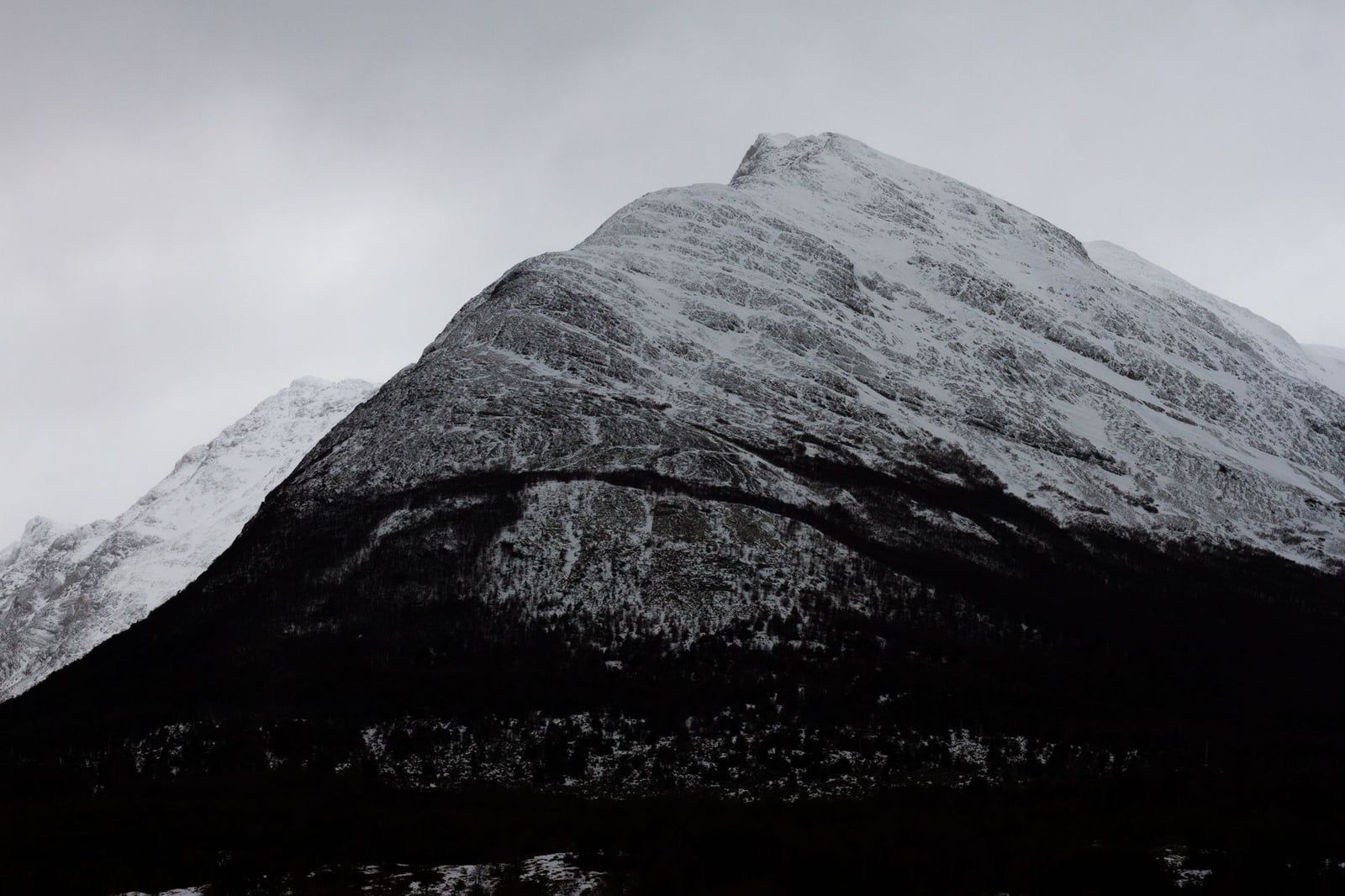
November through March is the prime window. Summer (December–February) brings highs of 13–14°C and up to 17 hours of daylight — long enough to hike the Costera, all six short trails and still catch a 7 pm shuttle with time to spare. October–November and March run similar conditions with fewer crowds and lower prices; April brings autumn colour to the beech forest. Winter (June–August) is a different sport: highs near 2°C, lows around −4°C, one to three sun hours a day, and official closures of Cerro Guanaco, Pampa Alta, Senda Costera, Cascada Río Pipo and the Ensenada Zaratiegui and Río Pipo access roads. Snowshoeing the lower trails is popular — our guide to the park in winter covers what's actually walkable.
Daylight is the hidden variable. In December you can start at 8 am and still be walking at 9 pm; in April the park closes the gates at 6 pm and the light goes earlier. Plan summit days for the longest days, and shoulder-season days with a firm turnaround time.
The weather story is wind. Average speeds run around 20 mph, gusts hit harder on the exposed Costera beaches and the Guanaco ridge, and a sunny hour can turn to sleet without warning — four seasons in one day is the local default, not a saying. It's the main reason rangers turn hikers back from the Guanaco summit, and it makes 10°C feel like 2°C. Check the forecast at the entrance before committing to anything high, and take the shell even when the sky is blue.
What to Pack
Dress for wind-driven weather, not for the forecast. A base layer, a fleece or light down jacket, and a wind-and-waterproof shell cover everything the sky can throw at you here; add gloves and a beanie, because cold ears will end your day before tired legs do. Waterproof hiking boots with real grip are the footwear call — the Costera is often wet, and every trail serves up mud, roots and rock. Trekking poles earn their strap weight on Cerro Guanaco and Laguna del Caminante; skip them for the Lapataia loops.
Food is on you. Pack lunch and snacks in Ushuaia — the Alakush restaurant is the only place to buy anything, it's pricier than town, and it closes by 17:30. Carry a refillable bottle; park water sources are streams you'd want to treat.
And the digital reality: there is zero cell signal inside the park gates. Download offline maps (Maps.me or AllTrails work fine) before you get on the shuttle, and on longer treks tell someone your route and expected return time. Paper matters here in a way it doesn't in most national parks — rangers will ask for your plan when you register anyway.
Frequently asked questions
How much does it cost to enter Tierra del Fuego National Park?
The official general (foreign adult) day rate is AR$40,000 from 1 June 2026, with Argentine residents paying AR$18,000 and students AR$12,000. Fees move with inflation, so check the official Parques Nacionales rates the week you travel. Entry has been free between May 1 and September 30 in recent years, and 3-day and 7-day flexipasses exist if you're staying longer.
How do I get to the park from Ushuaia without a tour?
Take the shuttle. Vans leave from the corner of Fadul and Maipú in central Ushuaia, tickets are bought on site (about AR$20,000–25,000 return), and the ride takes roughly 45 minutes with seven stops inside the park. A taxi day-hire (around US$100 for a half-day circuit) or a rental car are the other no-tour options.
What is the best hike in Tierra del Fuego National Park?
For most people, the Senda Costera: 8 km one way along the Beagle Channel from Ensenada Zaratiegui to Lapataia Bay, 3–4 hours through forest, coves and beaches. If you want the park's best panorama and a real workout, Cerro Guanaco climbs 8 km round trip to 975 m — about four hours up, with mandatory ranger registration.
Can you hike Tierra del Fuego National Park in winter?
Yes, with limits. Winter officially closes Cerro Guanaco, Pampa Alta, Senda Costera and Cascada Río Pipo, plus the Ensenada Zaratiegui and Río Pipo access roads. Stick to the short Lapataia trails — snowshoeing them is popular — expect highs near 2°C, and check conditions at the entrance before setting out.
Do I need to register for the Cerro Guanaco hike?
Yes — registration is mandatory at entry and exit, either through the official form or with the rangers. If the wind is strong, rangers will advise against the summit, and you should take that advice: the ridge is fully exposed at 975 m.
Is camping allowed in Tierra del Fuego National Park?
Yes, free at designated sites: Río Pipo, Ensenada and Laguna Verde have portable toilets, while Cauquenes and Laguna del Caminante have no facilities. Campfires using park wood are banned — bring a stove — and you must pack out all trash. A flexipass makes an overnight trip better value.
Can you walk to the Chile border on the Hito XXIV trail?
Yes. The trail runs 3.5 km one way along the northwest shore of Lago Acigami to border milestone XXIV — about 3 hours each way, out and back. No passport needed, since you stay on the Argentine side; the trail ends at the marker and you must not cross.
How many days do you need for hiking in Tierra del Fuego National Park?
One full day covers the Senda Costera plus the Lapataia short trails — that's the core experience. Two to three days lets you add the Cerro Guanaco summit or an overnight at Laguna del Caminante. Entry is often free in low season if a winter trip appeals.
Sources
- argentina.gob.ar/parquesnacionales/patagonia-austral/parque-nacional-tierra-del-
- argentina.gob.ar/parquesnacionales/patagonia-austral/parque-nacional-tierra-del-
- argentina.gob.ar/parquesnacionales/patagonia-austral/parque-nacional-tierra-del-
- argentina.gob.ar/parquesnacionales/patagonia-austral/parque-nacional-tierra-del-
- turismoushuaia.com/zonas/parque-nacional?lang=en_US
- trendelfindelmundo.com.ar
- en.wikipedia.org/wiki/Tierra_del_Fuego_National_Park