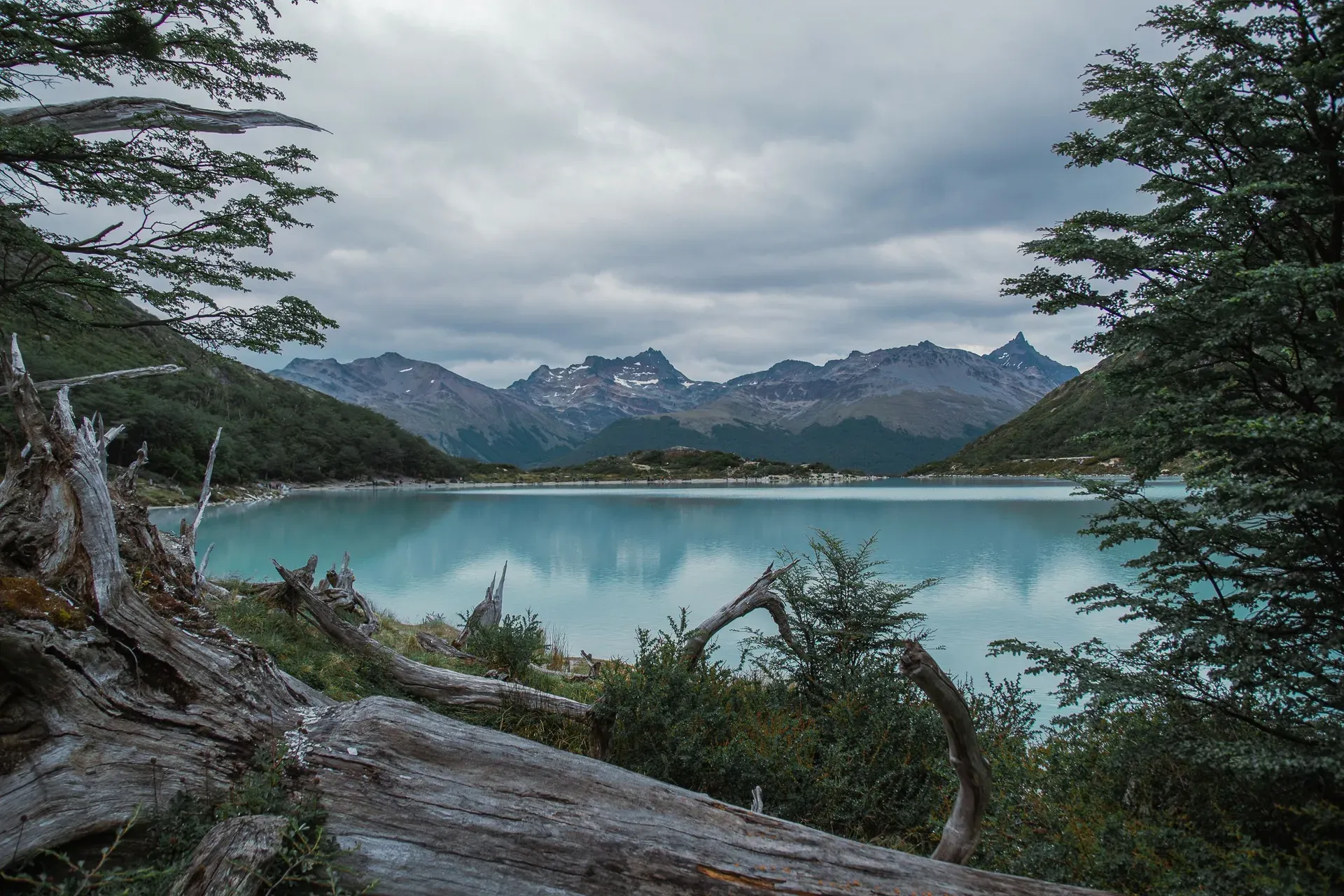
Tierra del Fuego National Park is Argentina's southernmost national park, protecting 68,909 hectares of subantarctic forest where the final peaks of the Andes drop into the Beagle Channel, 12 km west of Ushuaia. It's the only place in the country where a national park meets the sea — and the road through it ends, literally, at the bottom of the Americas.
Tierra del Fuego National Park protects 68,909 hectares of subantarctic Andean forest at the southern tip of South America, about 12 km west of Ushuaia. It's the only national park in Argentina with marine coastline — roughly 6 km along the Beagle Channel — and the only one where the southern Andes run straight into the sea. Created by National Law 15.554 on 15 October 1960, it was the country's first shoreline park, and it's managed by the Administración de Parques Nacionales.
Most of it you'll never see. Only the southern sector, about 2,000 hectares, is open to visitors; everything north of it is a strict nature reserve. That open slice still packs in some 40 km of trails, from the 900-metre Paseo de la Isla river loop to the steep climb up Cerro Guanaco to a 975 m viewpoint. A hop-on-hop-off shuttle runs from downtown Ushuaia to seven stops, and the End of the World Train follows the old prison railway into the park from September to April. At Bahía Lapataia, a sign marks the southern terminus of National Route 3, the Pan-American Highway — the end of continuous driving in the Americas.
Expect weather that changes its mind hourly. Summer (December–February) brings highs of 13–14°C and up to 17 hours of daylight, but wind averages around 20 mph and sleet can follow sunshine fast. Winter (April–September) officially closes several trails and access roads, including Senda Costera and Cerro Guanaco. Bring a windproof shell, waterproof boots and layers in every month. Entry costs AR$40,000 for foreign visitors at the official rate effective 1 June 2026, payable at the gate or online at ventaweb.apn.gob.ar — though with Argentine inflation, check the current figure the week you travel.
People lived along this coast for millennia before any park existed. The Yámana were nomadic canoe people, moving between camps on the Beagle Channel and lighting fires on the shore — the flames early European sailors saw from their ships gave the whole archipelago its name, Tierra del Fuego, Land of Fire. Their traces survive at Bahía Lapataia in the grass-covered shell middens (concheros) still visible beside the boardwalks: mounds of mussel, limpet and sea-snail shell and bone, built up over thousands of years of meals. Nineteenth-century contact broke the population. Missionaries, sealers and gold prospectors brought disease and displacement, and within a few generations the Yámana communities along the channel were devastated.
In the late 1800s Argentina built a penal colony at Ushuaia, and the prisoners became a logging workforce. Hauled up the Pipo Valley on a narrow-gauge railway, they cut the lenga beech forest for timber — the hillside of stumps now called the Tree Cemetery is their doing, and it's still a stop on the tourist line. Today's Tren del Fin del Mundo, a rebuilt steam railway, replicates the last 7 km of that prison route, with departures at 9:30, 12:00 and 15:00 from September through April.
On 15 October 1960, National Law 15.554 created the park — Argentina's first shoreline national park, protecting the country's southernmost forests where the Andes meet the Beagle Channel. An expansion in 1966 brought it to its current 68,909 hectares, running from the channel coast north towards Lago Fagnano and bordering Chile along the way.
Today the park lives on day tourism from Ushuaia, itself the world's principal departure port for Antarctic expeditions. The Administración de Parques Nacionales runs it from an office at San Martín 1395 in Ushuaia, posting trail status, hours and fees on its official site. Winter still closes the high routes. Some things here don't accommodate visitors — they never did.
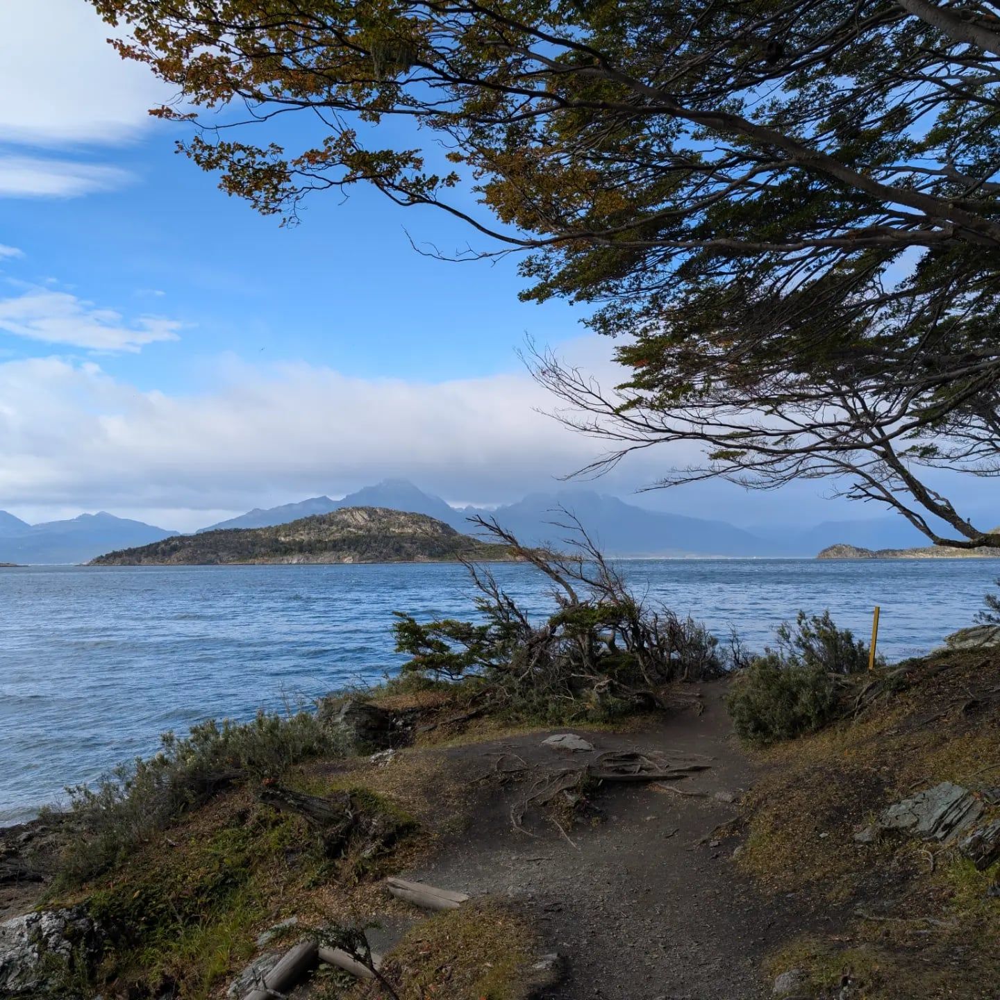
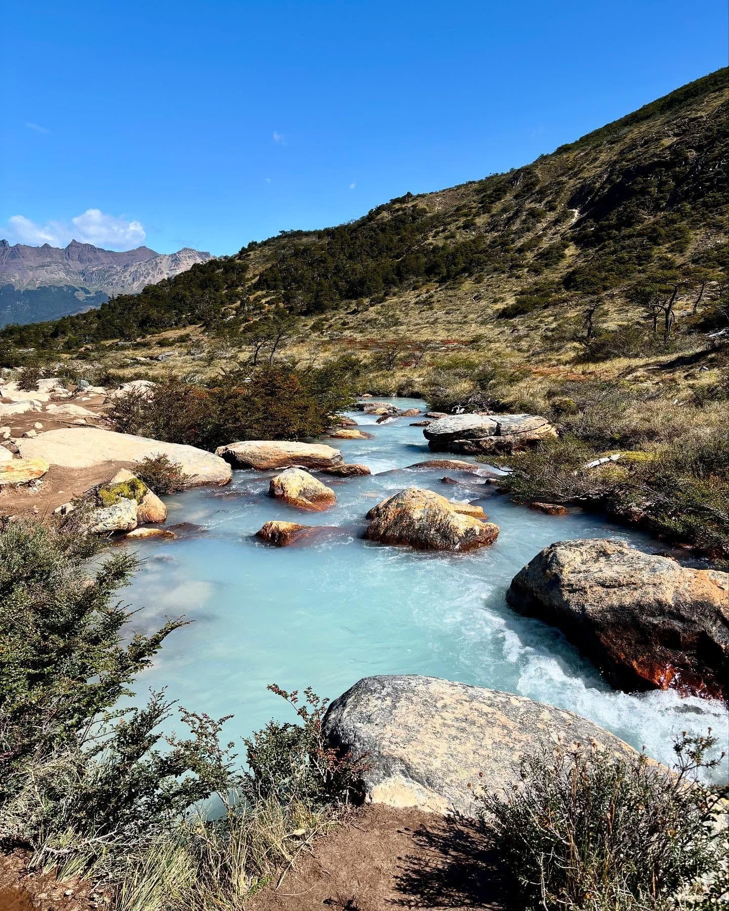
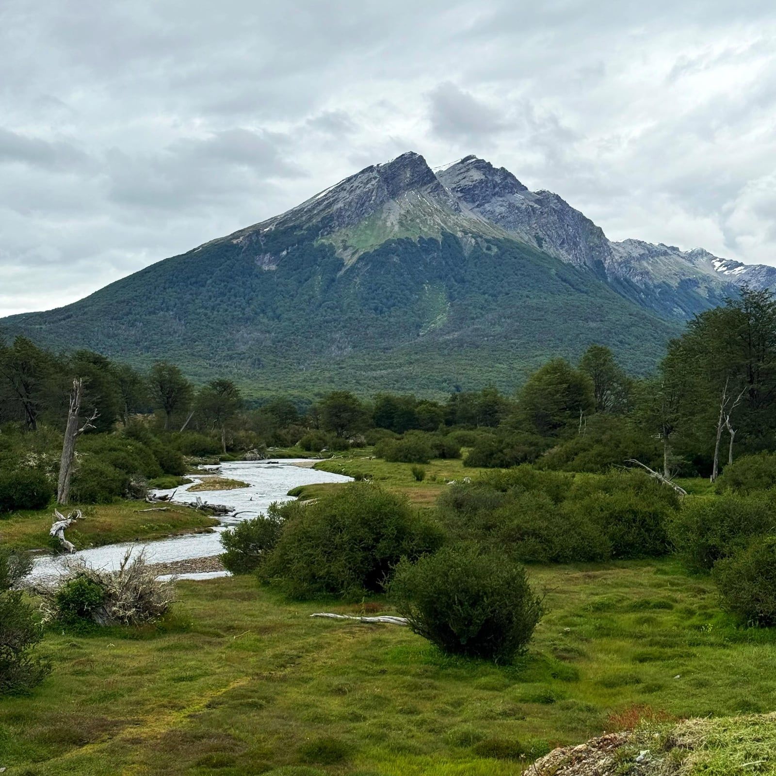
The park occupies the southwest of Isla Grande, the big island of Tierra del Fuego, stretching from the Beagle Channel coast north towards Lago Fagnano and running along the Chilean border. This is where the Andes give up. The range's final stretch plunges into the sea, and glaciers carved the valleys beneath it into lakes, river channels and extensive peat bogs — turbales — that take thousands of years to form. The forest is nearly pure lenga and guindo, two southern beech species that hold their dead leaves through winter and turn copper-red in April.
Water shapes everything here. Lago Acigami (also called Lago Roca) is the park's largest lake, shared with Chile; an easy 7 km round-trip path follows its shore to Hito XXIV, the Argentine–Chilean border marker, where the trail ends and you must not cross. The Lapataia and Ovando rivers drain into Bahía Lapataia, a bay opening toward the channel where cormorants perch on rocky islets. Land wildlife includes beavers (an introduced species whose dams dot the waterways), foxes, guanacos, rabbits and condors.
The trail network covers about 40 km. Senda Costera is the classic route: 8 km one-way from Ensenada Zaratiegui to Lapataia Bay along the channel, 3–4 hours through beech forest, rocky coves and pebble beaches. For the park's best panorama, Cerro Guanaco climbs 8 km round trip to 975 m — steep, exposed to wind, and closed all winter. Shorter walks suit families and shuttle-stop visits: Paseo de la Isla (900 m) follows the two rivers to the Laguna Verde viewpoint, Laguna Negra (950 m) leads to a dark peat-bog lagoon, and Mirador Lapataia (950 m) earns bay views with a brief climb. The Senda de la Baliza runs 1.5 km each way past an abandoned beaver lodge to a lighthouse viewpoint.
Beaches at Ensenada Zaratiegui and Lago Acigami are popular picnic spots in summer. Swim at your own risk — water temperatures sit at 4–8°C even in January, with no lifeguards or services. Most people stay on the sand.
The park's deepest meaning is in its name. Fires on the shore — the Yámana's fires — gave Tierra del Fuego its identity, and the shell middens at Bahía Lapataia are among the last physical records of a people devastated within living memory of European settlement. Walking the boardwalks past those grass-covered mounds is the closest most visitors come to the region's original inhabitants. The Yámana story also reached the wider world through writing: Charles Darwin described the canoe people he encountered here during the Beagle voyage of the 1830s, and Lucas Bridges, a son of the first missionaries, chronicled indigenous life in his 1948 book Uttermost Part of the Earth — still the classic account of the region.
For visitors, the park trades on its location at the literal end of the world. The Correo del Fin del Mundo, a wooden hut at the water's edge on Ensenada Zaratiegui, is celebrated as the southernmost post office in the Americas; people post cards with special End of the World stamps and get their passports stamped (unofficially, but famously). The Route 3 sign at Bahía Lapataia — the Pan-American Highway's southern terminus — is the single most photographed spot in the park, and for many travelers the whole point of the trip.
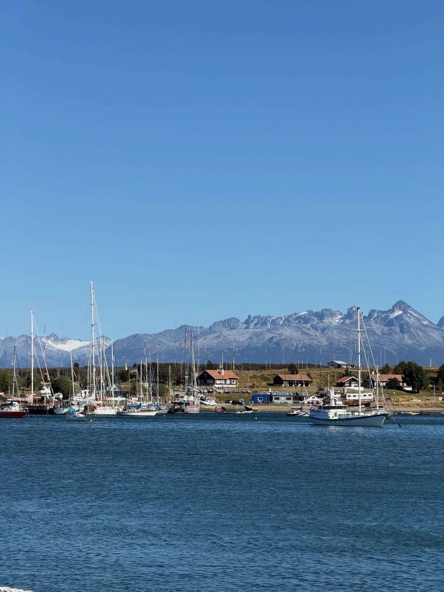
Locally, the park anchors Ushuaia's identity and economy. The town brands itself the Fin del Mundo, serves as the world's main departure port for Antarctic expeditions, and fills with cruise passengers and trekkers each austral summer. The prison history feeds the Museo Marítimo y del Presidio in town, and the tourist train keeps the memory of the convict railway alive. Argentine school groups visit free, and camping in designated areas costs nothing under leave-no-trace rules — the park belongs to the province's sense of itself as much as to the nation.
Bahía Lapataia holds the southern terminus of National Route 3, the Pan-American Highway. Drive south from Alaska and this sign is where the road — and the continent — run out.
Created in 1960, it was the first national park in Argentina with marine coastline, and it remains the only one where the Andes meet the sea.
Only about 2,000 of the park's 68,909 hectares are open to the public. The rest is a strict nature reserve with no visitor access.
The End of the World Train replicates the last 7 km of the Ushuaia prison colony's logging line. The Tree Cemetery — a hillside of stumps the prisoners left behind — is still a stop on the route.
A tiny wooden hut on Ensenada Zaratiegui claims the title of southernmost post office in the Americas, franking postcards with special End of the World stamps.
Recreational drone flying is prohibited in all Argentine national parks. Authorization from the national park administration goes to scientific and search-and-rescue work only.
Beavers, introduced to Tierra del Fuego decades ago, have dammed streams throughout the park — you'll pass their lodges and ponds along the Senda Costera and the Senda de la Baliza.
Official rates effective 1 June 2026: AR$40,000 for general (foreign and non-resident) visitors, AR$18,000 for Argentine residents, AR$8,000 for Tierra del Fuego provincial residents and AR$12,000 for students. Argentine pensioners with DNI, visitors with a disability certificate, Malvinas War veterans and accredited school groups enter free. Fees shift often with inflation — guides quoted figures ranging from AR$30,000 to AR$62,000 in 2025–26 — so check the official site the week you travel, and bring your passport or DNI to claim any category.
Take the regular shuttle from the corner of Fadul and Maipú in downtown Ushuaia — about AR$20,000–25,000 return as of early 2025 — which stops at seven points inside the park, including Ensenada Zaratiegui, the Alakush Visitor Centre and Bahía Lapataia. The End of the World Train is another option from its own station, and half-day guided tours (roughly US$79–145) cover transport with hotel pickup. The park is only 12 km away, so it all takes under an hour.
It's a roughly one-hour, 7–8 km steam ride replicating the Ushuaia prison railway, with stops at the La Macarena cascade and the Tree Cemetery and an audio guide in 10 languages. Tourist class costs AR$70,000 and premium AR$217,000 (2026), and park entry is extra. It's touristy but historically interesting — a common move is riding it one way and returning by shuttle or tour bus.
Senda Costera is the classic: 8 km one-way from Ensenada Zaratiegui to Lapataia Bay along the Beagle Channel, taking 3–4 hours through lenga and guindo forest, coves and pebble beaches. For a harder workout and the park's best panorama, Cerro Guanaco climbs 8 km round trip to a 975 m viewpoint. Shorter options include Paseo de la Isla (900 m) and the 7 km round-trip walk to the Chilean border marker at Hito XXIV.
Not inside the park itself. Magellanic and Gentoo penguins breed on Beagle Channel islands such as Martillo Island from October to late March, reached by boat or combined tours from Ushuaia starting around US$79. Inside the park, expect cormorants on the islets near Bahía Lapataia, plus beavers, foxes, guanacos, rabbits and condors on land.
The park is open daily, year-round, with seasonal hours: 8:00–21:00 from December to February, 8:00–20:00 in March, October and November, and 9:00–18:00 from April to September. The Alakush Visitor Centre, with its restaurant, restrooms and gift shop, opens roughly 10:00–17:30.
No reservation is needed for a regular day visit — buy your ticket online at ventaweb.apn.gob.ar or at the gate. The End of the World Train should be pre-booked, especially from May to August when departures depend on availability, and penguin and Beagle Channel boat tours sell out in summer.
Yes. National Route 3 runs from Ushuaia through the park and terminates at Bahía Lapataia, making it the southernmost end of Argentina's segment of the Pan-American Highway network. The sign marking the end of the road is one of the park's most photographed spots.
Yes, camping is free in designated areas such as Laguna Verde, under leave-no-trace rules — pack out all trash and don't alter the ground for tents. Fires are only permitted with charcoal or commercial firewood; collecting park wood is prohibited. Some higher-difficulty trails require registration at entry and exit.
Swimming is possible at beaches on Ensenada Zaratiegui, La Baliza and Lago Acigami, but there are no lifeguards or public services, and water temperatures sit around 4–8°C even in summer. The cold-water risk is real, so most visitors treat the beaches as picnic and photo spots.
Browse verified tours with free cancellation and instant confirmation.
Find Tours